Somerset Flooding- A silver lining lost

A year or so ago  when Sedgemoor District Council (SDC) and the Environment Agency started work on  the Bridgwater Tidal Barrier  (BTB) scheme they jointly decided not to spend money on an economic impact assessment.

As  a result of that decision there is now no way for councillors, ratepayers and business to measure and benchmark the wider commercial and economic impacts of BTB project.  The project  is now simply valued and measured by government rules. This is especially important for those ratepayers and the HoW LEP who will directly pay for a proportion of this scheme.  For Somerset’s councillors there is no visibility of  the potential direct local (Somerset wide) benefit. With a preferred location agreed and the full details still yet to be seen or shown to the public it is difficult to see  how the Bridgwater Tidal Barrier  can be proceeding as it is.

There is a need to scrutinise the  EA’s proposed Bridgwater Tidal Barrier and its management of the delivery of the scheme. There urgently needs to be some form of independent peer review to support the decisions of councillors and EA employees who do not have suitable engineering qualifications and experience. No private company would do this.

The  River Parrett catchment  and its capacity affects much of South and Central Somerset; almost every town is on one of its tributaries. The wider opportunity that Somerset’s flood defence expenditure presents has to date been largely ignored and is in danger of being squandered. Sensible promises made in 2014 have been quietly allowed to disappear.

If you live within the Parrett Catchment or  in West Somerset this article will be worth reading for economic reasons alone.

River Parrett Catchment Area

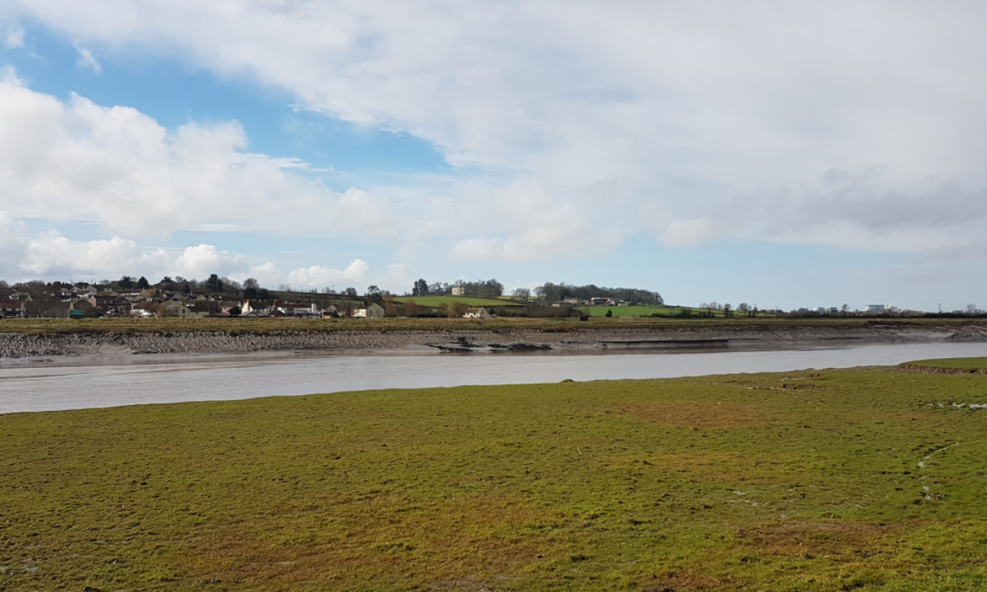
By 2024 nearly £100M will have been spent on flood related work within Somerset and the majority of the money focused to the north and north west of Bridgwater. The EA’s  managed realignment at Steart Peninsula and the adjacent Bristol Ports property deal for it proposed container port that is of no economic benefit to Somerset sees nearly 3000 acres of farmland removed from the the local economy.

However

  • The Levels will still flood and as they did in 2014; they will simply drain more quickly.
  • A flood defence system will have been built that only works for sea water (tidal) and that will probably have to be replaced because it will not be viable to extend its design  life because of the ground conditions along the river banks.
  • The expansion of Bridgwater over the next 100 years ignored.
  • The rather novel concept of putting a tidal flood barrier 5 miles upstream of the mouth of  the River Parrett and into the town implemented.
  • An additional 2,000 acres of productive agricultural land will be in the process of being lost  to agricultural bringing the total of land lost to the local economy to 5,000 acres including Steart Peninsular and the Bristol Ports land deal.
  • There will be no bridge over the Parrett although the myth that you cannot easily have both on one structure will have been discredited albeit too late.
  • No beneficial integration with a future Bridgwater bypass considered or provided.
  • An important relationships  between the capacity of the KSD/Sowy expansion and the impact of the location of the BTB never mentioned or costed.
  • The planned loss of Pawlett Hams to the sea lying hidden in the Parrett Estuary Flood Risk Management Strategy.

Perhaps the most unfortunate decision to date  was naming  the barrier/barrage the Bridgwater Tidal Barrier and sending mixed messages as to its purpose. That single act has reduced interest and scrutiny both in Sedgemoor and further afield to almost nothing. Only 180 people came to a public consultation in September 2016.

The  introduction on the SDC barrier website reproduced below implies on the last line that it “could play a critical role in reducing flood risk” (tidal) and not the fluvial flow it started talking abut; they are not the same thing but did meet once in 2014. Two different things have been conflated  into one message.

The barrier is not designed to mitigate a another 2014 flood

with regard to fluvial (rainfall) flooding

  • Would it now have had an impact on another 2014 flood?          NO
  • Could it be made to have an impact on another 2014 Flood       YES.

Somerset’s councils seem to have no interest in this scheme yet they should because

Somerset County Council (SCC)

Despite having the SRA under its wing and councillors jointly at County and District level there is little in the way of a long term vision that can be see being developed.

A shorter more strategic tidal scheme closing off the South Somerset Levels from the sea  by closing the short gap between the hills from Combwich to Pawlett Hill has not been considered.

Such a scheme would

  • Secure the south Somerset Levels from the sea.
  • Improve the fluvial capacity of the River  Parrett to the benefit of Taunton Deane and South Somerset as well as Sedgemoor.
  • Provide a bypass and improved  road link to West Somerset using EDF’s extended Cannington Bypass.


West Somerset

West Somerset’s economic development is constrained by two roads (A39 & A358) and the need to navigate across either Bridgwater (A39) and Taunton (A358)  road systems to get to the M5. With little or no options and no Government money available as part of its road budget it is an area of Somerset where the wealth and opportunity of its population is always constrained and likely to continue. No doubt why it loses industry and income.

It is difficult to understand why West Somerset isn’t trying to improve its economic link to the M5 motorway and via the A39  to Frome, Wells, Shepton Mallet, Street, Glastonbury and Yeovil.

Constructing the Bridgwater Tidal Barrier at Combwich with a road bridge taking advantage of the recently constructed EDF extension to the Cannington Bypass would provide a significant economic benefit to West Somerset.

Taunton Deane & South Somerset

Both local authorities rely on their respective tributaries Rivers Isle, Cary and Tone to convey surface water to the River Parrett and onwards to the sea. No amount of SUDs, storage on the Levels or slow the flow is going to change the fact that you can only get so much fluvial flood water out through the River Parrett. That constraint will ultimately have to be faced by limiting economic development  The opportunity has not been taken to leverage  the long term benefits for the two districts by moving the  barrier downstream.

The reason to relocate the  selected  Bridgwater Tidal Barrier site downstream is that its preferred location does almost nothing to improve the conveyance of surface water to the sea. Where it is now proposed above the King Sedgemoor Drain outfall means that the full benefit of the KSD/Sowy expansion cannot be achieved or the capacity of the River Parrett optimised. Capacity that would benefit largely Taunton Deane and South Somerset. That scheme is being paid for by everyone and is simply not as good value for money as it could be. Rising sea and tide levels will reduce the time the KSD sluices can discharge. That situation will invariably negatively impact both districts by limiting how much water can go in to the system at their end.

It is therefore surprising that neither council has been pushing the barrier downstream where it could be used to increase conveyance in the same way as the Thames Barrier does. Increasing the overall capacity of the system when the Levels again flood is the priority and an opportunity not to missed offers one less obstruction to those two districts economic development.

Sedgemoor District Council (SDC)

South Somerset Levels

Sedgemoor opted to support a 15Km long scheme that cannot be extended (raised) as sea levels rise. Somewhere a bigger one will be required. Its consultants never looked at what would be the best scheme for Somerset or indeed wider Bridgwater. It is just what would be the cheapest for the EA whilst the SRA and SDC looked on. A location for the barrier where a bridge cannot be added to it is hardly planning for the future but it does ensure the ratepayer does not get value for money.

North Somerset Levels

Defending the North Somerset Levels could be achieved by the construction a new barrier from the Polden Hills to end of the Mendips (Brean Down). Such an undertaking could be easily done providing undeveloped land is identified. We could create a second line of defence over the next 30 years letting Somerset contractors run recycling operations allowing trains to bring in recycled materials to form a continuous flood defence. Its time managed retreat was abandoned.

What is disappointing is that with the SDC Local Plan under development there is no land being reserved for future improvements to the flood defences. The organised surrender of Somerset’s hard won land is being orchestrated by the EA under its Managed Realignment process and no one is challenging it. Everyone in Somerset should be interested in what is being done along the coast for safety and economic reasons. There is simply no plan.

Heart of the South West LEP

The Heart of the West LEP with its support of the BTB a project will ultimately damage local businesses based in most districts (£16-20M of lost land values) whilst in a current study is looking at improving rural businesses . The LEP is an organisation facing both ways to the detriment of everyone.

Somerset needs some joined up thinking and understand the very negative implications of some of Somerset’s flood defence scheme.Only when its built and its limits apparent will people say “if only”. 

The Options looked at by the EA lacked any sort of imagination or offered a long term solution; were simply variations on a theme and ignored the nearby topography that offered other options for the Bridgwater Tidal Barrier

It is unacceptable that better engineering options were not  identified and presented to councillors; ultimately it should be the ratepayers decision to go for a better solution if they want to. The EA should not presume as it has in this case.

On the 14th July  starting at 10.00 am  the first opportunity to do something takes place when the SRA scrutiny committee meets in open session at Somerset County Hall, TA1 4DY. 

Some Questions to Ask

  • Why is the Bridgwater Tidal Barrier not also designed to help to mitigate the effects of a similar flood to 2014?
  • What is the replacement plan for the Bridgwater Tidal Barrier?
  • What is the cost of a scheme with a bridge ?
  • Should we only be spending our money on such a limited scheme?
  • Why wasn’t Combwich and the resulting shorter flood defence system that protects a larger area than the current scheme considered by the EA?
  • Does the extension of the Cannington bypass towards Combwich necessitate the reassessment of the present scheme?
  • Should Somerset County Council be looking at a more holistic scheme for Somerset?
  • Should SCC commission a county wide economic assessment of what an alternative barrier scheme might deliver?
  • Do we need the EA or should the SRA be expanded to become a delivery focused organisation and the EA limited to a statutory consultee ?
  • Is the role of environmental charities in developing and influencing flood policy beneficial and do they have a conflict of interest?
  • Why after 3 years since the flood and 8 years since the barrier identified as the preferred solution is there almost no information about the scheme on the http://www.sedgemoor.gov.uk/bridgwaterbarrier website?

The EA plan another consultation on the full scheme later in 2017. Councillors of all Somerset’s districts  might like to look at the economic impact of this scheme (BTB) on their own areas and perhaps county might look at the bigger picture.

An unintended consequence is only the failure to adequately consider a decision before it was made.

The River Parrett – how it works

Rivers that discharge into the Severn Estuary are very different from most UK rivers. With a tidal range in the estuary of around 11m  MLWN -3. 0 and MLWS -5.7 AOD and the river bed level at around 0.00 AOD.  These levels means that at low tide in the estuary the water level is always below the bed of the River Parrett and the river simply empties into the estuary. In the case of the Parrett its a process that goes as far upstream as Oath and the changing tide sees the river refilling from the sea.

What is seen looking over the Bridgwater’s bridges is just one half of the normal tidal cycle you would see at the coast; at low (ebb) tide its purely fresh water going out and that can be seen on the West Quay tidal gauge where the graph flattens. Equally the point at where incoming seawater (saltwater)  takes over from the  freshwater of the Parrett and becomes  a relatively small component of the rivers water can also  estimated.

At low tides the river empties so completely that during periods of low fluvial flow it can actually dry out so much so that upstream of Combwich there is an old iron age path where people simply walked across the river at low tide.

High tides can be nearly 2m above the surrounding land and at Bristol Road nearly as high as the head of the doors and over the next hundred years that will  continue to grow .

Ecologically it is largely a  dead river. Nature likes, however bad, a consistent environment and the Parrett offers the greatest of changes twice a day from empty to full and freshwater to saltwater. The large amounts of Seven Estuary silt that arrives with the tides exclude sunlight and there is nothing to generate oxygen. Fish(salmon) and Elvers just transit the river on their way to the fresh water of the River Parrett and its tributaries.

It is a true challenge for The EU Water Framework Directive as  there is little negative actions that can be done to it. The lack of water does not deter unrealistic claims that fisheries exist in the river.

The images below show River Parrett tides ( courtesy of  GaugeMap)

West Quay One days Tides
West Quay One weeks Tides
HPC Tide Gauge

The Hinkley Point tide gauge above shows the full cycle of the tide in compoarison to the truncated cycle at West Quay which is caused by the river bed being higher than the sea bed in the Seven Estuary.

West Quay- One Months Tides

Looking along the river it could be shown

River Parrett at Low Tide

2014 Flood

In 2014 the Somerset Levels flooded, normally excess water is stored on the levels and then pumped back into the river  when the weather improves and fluvial flows have reduced. The floods occurred because the flood storage capacity  of the land was exceeded.

The response to the flood and still the current plan is pumps some more fixed ones and temporary platforms for hired pumps such as the permanent platform at Dunball made ready for the next time the levels flood and improvements made to how fast the flood water can be drained off the Levels.

One important question is whether its  possible to increase the  amount of water that flows  down the river without pumps? 

The answer is yes;  the Thames Barrier is used in that way when there is flooding and the Thames and its tributaries are at capacity. The barrier gates are closed at low tide creating a shallow reservoir normally filled by the incoming tide and floodwater coming down the river fills it up. Previous references to the Thames Barrier and the River Parrett were in relation to the type  of gate rather than how the system operates.

How might it work in the River Parrett?

There are two sources of fluvial floes into the Parrett. The Parrett and King SedgemoorDrain (KSD) /Sowy River.  Water unable to get down the River Parrett is diverted around Bridgwater via the KSD/Sowy and re-enters the Parrett at Dunball.

Dunball Clyce (River Parrett side)

Both  sources can discharge when the tide is out  but become tide locked when the sea re-enters the river.  Creating a large temporary empty length of river downstream of Dunball would allow both sources to continue flowing and when full and matched with the tide allowed to go to the sea.

River Parrett – Increasing the Flow

To do this a gate is needed downstream of Dunball and the best location would be Combwich or somewhere in between.  The Bridgwater Tidal Barrier is a gate that could  have been used to do this.

EA  Downstream  Scheme 

The   current plan is to build the Bridgwater Tidal  Barrier upstream of Dunball Clyce and with sea and tide levels continuing to rise  allowing the sea to reclaim the farmland  at Chilton Trinity and Pawlett Hams.  The existing  system returning to an inter tidal saltmarsh/mudflat covering the existing farmland at Pawlett Hams and most of the land to the north of the village of Chilton Trinity. The drawing below shows how the regime will change over the years to come.

River Parrett at Chilton Trinity & Pawlett Hams showing planned next 100 years

The information can be found in

The Parrett Estuary Flood Flood Risk Management Strategy

Full copies of the EA policies can be found at

Steart Peninsula (Stolford to Combwich) 7d34 to 7d37

Parrett Estuary (Combwich to River Brue) 7d38 to 7d42

further information with flood maps can be found in the article on

Chilton Trinity and Pawlett Hams


Somerset’s 20 Year Flood Action Plan is not a Plan

Has anyone noticed  there actually isn’t really a plan for managing flooding in Somerset  be it Tidal or Fluvial. Lots of headlines and pictures of grandstanding councillors on river banks  but little substance.  Our particular collective flood Emperor has no clothes whilst the myth that somehow the Bridgwater Tidal Barrier (BTB) is part of the solution to the avoiding a repeat of the 2014 flood is allowed to persist. People imagine that things are being done and there is a big picture somewhere. There isnt.

The Somerset 20 Year Flood Action Plan is little more than a  maintenance list that should have been done and wasn’t; it is a complete misnomer. In three years since the 2014 flood  there is no  big plan looking forward  the next 200 years. There is no context that  explains where the value of all the money being spent is.

There is no excuse for such short sighted behaviour by our officials and elected representatives. At least the Somerset Rivers Authority (SRA) carried out an economic impact assessment of the 2014 flood which is more than the EA and Sedgemoor District Council (SDC) have done for the Bridgwater Tidal  Barrier.

The development of new ideas  seems to be more akin to those seeking alternative medicinal remedies; they seem to be ones that will turn the Levels into some theme park rather than look at something that can be delivered over the decades and centuries ahead. The  Managed  Retreat (Realignment) of our coastline is not a panacea to rising sea levels; it has its place but  needs to be challenged when there are viable options.  Giving the EA the excuse and licence to do little or nothing is not acceptable. Those involved with W&WT and the RSPB as consistent beneficiaries of these  EA policies and alongside Natural England makes an unholy alliance  that is no friend of Somerset’s people.

Plenty of councillors are sat on committees and they should be ensuring rigorous debate and the publishing of useful information rather than the almost complete lack of detail in the public domain. The private sector would not be allowed to get away with this lack of transparency or vision.

Since 2014 when it was rushed together for political expediency  little has been done or achieved whilst show case projects are not what they seem

Bridgwater Tidal Barrier

Despite knowing that  the rise in sea level  has no recognised end date Somerset has decided on a  100 year scheme. Our King Canute moment.

We are going to build a scheme that cannot be easily extended or modified knowing full well that something else will be needed in the future but we haven’t decided what. A scheme that  unlike any conventional tidal surge barrier  it is  actually to be in the town rather than down stream and at the mouth of the river. Bridgwater in  probably 10 rather than 100 years will have enveloped the proposed barrier site.  A solution with built in obsolescence that  can be bypassed on day one does not seem a great idea. Children born today may see the BTB torn down. Why would Bridgwater  buy it?”

Options such as closing the gap between Stockland Bristol  and Pawlett Hill less than 2 Km  ( 1.3 miles) long compared to around 15 km (10 miles) both banks from Combwich to the selected site in Bridgwater or 7.5 Km  if you allow Pawlett Hams to go the way of Steart Peninsula.

Two option studies paid for by the taxpayer and Combwich  not even considered as an option in either and the  backdoor flood route at Walpole still not acknowledged when the EA visits landowners. The credibility of the EA , its consultants and our oversight committees is very poor.

King Sedgemoor Drain Improvement

The King Sedgemoor Drain improvement is a Fluvial conveyance scheme that cannot reach its full potential because of the location of the tidal BTB upstream of Dunball Clyce. The EA in this matter described themselves in recent correspondence as the SRA’s sub contractor.

Silos

Flood schemes are kept in silos of fluvial and tidal rather than in developing a single holistic solution for Somerset. The EA and other organisations make it very difficult  to see the full picture. There is a serious lack of transparency,  accountability and independent review in the process.

By 2024 nearly £100m will have been spent and the Levels will still flood. The Bridgwater Tidal Barrier is seen and portrayed as a Bridgwater only scheme where as moving it downstream  of the KSD outfall would increase conveyance  under fluvial conditions benefiting the districts of Taunton Deane and South Somerset. The SRA is nowhere to be seen generating debate and  bringing together people to achieve a wider benefit to Somerset with state and local ratepayers money which was its reason to be created. The SRA’s one big opportunity missed. This is notwithstanding the missed economic opportunity for West Somerset

Transparency

There is more information in the public domain about EDF’s Hinkley Point C power station then there is about these schemes especially the Bridgwater Tidal Barrier. It appears  the EA did not want the Chilton Trinity  and Pawlett Hams landowners to be aware of  what would not be done to protect their land choosing to hide behind the rather opaque Parrett Estuary Flood Risk Management Strategy. Something noticeably low key to the point of invisibility  in the EA’s 2016 consultations at the Bridgwater Art’s Centre.

The reasons  that undertakings given by the EA and SDC in Protecting Bridgwater and the Somerset Levels & Moors from Tidal Flooding-Flood Risk Management Review -November 2014 were never followed through and just quietly dropped has never been explained.

No imagination  and no vision for our children’s future

With a blank sheet of paper and little or no restrictions on what we might do to protect the South Somerset Levels including areas of Sedgemoor, Taunton Deane and  South Somerset there is still a blank piece of paper. Rarely has such an opportunity been squandered.

There is nothing that explains what happens to the Tidal Surge Barrier when we cannot raise the banks any longer which in reality we cant now and Pawlett Hams and Chilton Trinity have become mudflats/ salt marsh  and the cost of building downstream  prohibitive.

What we do have is lots of committees

Wessex Regional Flood and Coastal Committee (RFCC)

Board of the Somerset Rivers Authority (SRA)

SRA Joint Scrutiny Panel

Somerset Drainage Board Consortium (IDB)

Its interesting to note how many people sit  on more than one of these committees. These committees  have people with no engineering knowledge or experience apart from the EA & IDB and all EA’s donkey work is done by US and Canadian third party consultants with no attachment to the area. The EA’s contribution to Somerset is questionable now as they have been reduced to little more than a middle man.

we must also not forget the groups

  • SRA  Management Group
  • SRA Technical Group
  • Bristol Channel Strategic Coastal Group
  • South West Coastal Group
  • Southern Coastal Group

It really is time that Somerset had  a suitable organisation capable of bringing a long term vision to secure the future of Somerset. Whilst attendance at committees is so lucrative  nothing is going to get done .  The EA is not a delivery based organisation and needs to be changed or replaced.  The SRA has no structure or suitable people able to develop and execute the vision and solution we need. The system  we have is clearly not fit for purpose.

The situation for Somerset, the rest of the West Country and no doubt other regions of the UK is that they need their own independent Engineers with local knowledge. Engineers able  to provide continuity  in advice to the committees and oversee the EA and IDB and other agencies.

We cannot afford

  • that each agency (EA, Highways, Rail) continues to builds its own thing, we need to combine flood defence with other infrastructure works.
  • that strategic flood decisions can be left to seconded senior local authority officers  with little or no knowledge of the subject.
  • the lack of an independent peer review process.
  • The lack of transparency – there is nothing published on the BTB website that tells you why.  There is little value value in an undated progress report  that can be found there  that does not measure progress. 
  • all these organisations whose main purpose seems to be to invite people from other groups to attend their meetings at our expense.

WE NEED A PLAN and we need to end the Flooding Golden Goose. 

on the 14th of July 2017  a meeting of the Scrutiny Committee  will take place in Taunton . It is open to the public. 

http://www.somersetriversauthority.org.uk/about-us/sra-scrutiny-meetings-and-papers/


West Quay Collapse

In November 2011 a section of Bridgwater’s West Quay collapsed. It was an old quay wall, possibly medieval in parts and close to or at the location where the demolished Bridgwater Castle  would gain access to the River Parrett. Whilst there is no official report explaining the failure it was probably the usual one;  a build up of water behind the wall that exceeded the ability of the wall to  resist it. It had rained very heavily beforehand. This is why holes are provided at the base of retaining walls to let the water escape and reduce the water pressure behind. Old walls often fall over and some relatively new ones fall over as well.

However since collapse the EA and Sedgemoor District Council  appears to have developed their own interpretation on the collapse implying that West Quay is a flood defence  which it isn’t. It was part of the old port of Bridgwater and the legacy of that commercial activity.

The EA’s public 1016 consultation boards on the Bridgwater Tidal Barrier imply that the West Quay collapse would not have happened if the Tidal Surge Barrier and its associated defences had been in place which  is implausible to say the least. It also makes a statement that the wall was in poor condition, who knows what condition it was in and a wall can be in perfect condition and still fall over if its capacity is exceeded.

EA Barrier Location Consultation March 2016
EA Barrier Consultation September 2016
Sedgemoor Draft Local Plan 2017

Sedgemoor ratepayer’s have been asked for comments on the location of the the Bridgwater Tidal Barrier in 2016 and the Draft Local Plan in 2017. They rely on the efficacy of the information provided by our statutory authorities and in the case of West Quay  the information and the story presented seems questionable.


A Tidal Surge Barrier, A Bridge & Dunball Wharf

One of the problems with building the Bridgwater Tidal Barrier downstream of Dunball Wharf is the marine traffic to Dunball Wharf. Sedgemoor District Councils current draft local plan states “The Council will support the continued operation and potential development of Bridgwater Port including Dunball Wharf and Combwich Wharf (Policy D16 applies). It will also support the re-establishment of active commercial wharf’s at suitable locations elsewhere on the River Parrett. In all cases the construction or operation of new wharf’s should not adversely impact upon the Severn Estuary internationally designated site.”

The reality is that  the Dunball Wharf’s with their tidal drying berths, dependency on  high tides and difficult navigation is never going to be a commercial success but the 200m wide river at Combwich might. Construction of  the tidal surge barrier could enable the relocation of Dunball Wharf to a better location.

Much hangs on what is considered to be adverse.

Concepts of what the river structures might look like have not been forthcoming since 2009. Apart from the tower  and turning vertical gate Bridgwater’s gate structure will be considerably shorter than the Hull Barrier structure we have  been repeatedly shown.

What would a barrier with a road bridge  options look like?

Another wharf at Combwich, EDF have  one there already, would not require an opening bridge or clearance much more than Drove Bridge on the NDR. A tidal surge barrier with a 40m fixed navigation span and a road deck might look like

Keeping Dunball Wharf  would require a one larger gate and an opening bridge. Dunball currently sees 40 or so vessel movements a year so its operation would not affect the bypass traffic.

The engineering is relatively simple and with a purpose built wharf everything could be shipped in during construction.


The Great Bridgwater Gate Debate

Bridgwater’s has had a long running debate over the type of gate for the proposed tidal barrier. Bridgwater Town Council and the Inland Waterways were led to believe that only a rising sector gate, similar to the Thames Barrier, could deliver the penned solution which they want in order to maintain the water level in the river and that would be delivered. As an an attendee to the September consultation the message of a rising sector was firmly reinforced to the public when a video of a rising sector gate was continuously shown at the now selected site and various supporting images included on the static displays.

The rising sector gate aka Thames Barrier was always a red herring and never going to be built. Only a barrier downstream of Dunball where the Hanson dredgers transit to Dunball might  have supported an argument for it.

Regardless of the merits of Penning the River Parrett the point made by the EA that penning could be incorporated at a later date is well made. To illustrate how that might be achieved can be seen below

Typical proposed Vertical Gate
Modified Barrier with Penning weir added, gates omitted for clarity.

Once the planned barrier has been built it would not be difficult to do  this if it was wanted.

What is more concerning is that after 2  years of presentations  people deeply involved in reviewing  the scheme  still do not understand  it. That they feel they were led to believe  a rising sector gate would be provided is completely understandable. It is also something that despite the issue  being closed in  November 2014 the EA have chose to keep open until now.   References to The Thames Barrier, Boston and Ipswich  were at best inappropriate. The Thames Barrier actually consists of a number of  other vertical gate  such as  Barking Barrier, Dartford Barrier as well as the more famous one.

Does  the gate type actually matter? No.

It is a  lesson to those presenting options to the public and our representatives.

Bridgwater Tidal Barrier Location

Today the Environment Agency and Sedgemoor District Council confirmed the recommendation to build the Bridgwater Tidal Barrier within the town.

If this is built at this location everyday millions of cubic metres of saltwater will unnecessarily be brought up the river into the town and particularly North East Bridgwater. Ultimately we will get the very flood this is meant to prevent.