Bridgwater Tidal Barrier; EA submits Planning Application via Transport and Works Act

The Environment Agency has recently submitted its application to build the Bridgwater Tidal Barrier through the Transport and Works Act (TWA). Its rather like a planning application to Sedgemoor District Council but in this case its to the Secretary of State.

The EA TWA submission repeatedly sets out 10 objectives for this scheme and this article examines whether the Barrier we are being sold does what the EA and SDC say is on the tin.

DOES THE BRIDGWATER TIDAL BARRIER MEET ITS OBJECTIVES?

Description

The scheme consists of two elements designed to keep the sea out of Bridgwater town centre for the next 100 years. Dunball and Bristol Road have to take their chances if there is a breach where as Chilton Trinity gets a second level of protection.

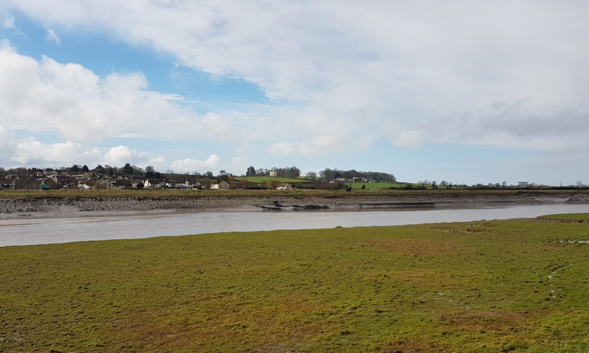
Ultimately the EA plan is to hand over the existing downstream fresh water habitat to the sea creating an inter-tidal habitat. The effect will be to bring the coast from the Steart Peninsula up to Dunball converting the existing farmland to mudflats and salt marsh.

The BTB consists of two elements.

  1. 7 miles of improved river banks that will be maintained for 20 years after the construction of the BTB after which that maintenance will cease and the frequency of the saltwater inundation on the land will be allowed with increasing frequency and the freshwater habitat poisoned.

2. A large reinforced concrete structure with two lift gates located in unconventionally inland and exposed to salt water with a large tidal range that causes one of the most corrosive mechanisms for this type of structure.

The EA / SDC / SRA Objectives

These objectives are presented with no basis as to how they were arrived, what the pass fail criteria is and the implications of not meeting the objectives.

  1. Reduce tidal flood risk to the highest number of properties and commercial businesses in Bridgwater and the surrounding are
  2. Reduce tidal flood risk to critical infrastructure and utilities in Bridgwater and the surrounding area
  3. Deliver a scheme that can be adapted for the future effects of climate change.
  4. Align the project with the strategy set out in the PEFRMS (see also Section 2.2).
  5. Align the project with the recommendations set out in the ‘Protecting Bridgwater and the Somerset Levels & Moors from Tidal Flooding, Flood Risk Management Review’ (Black & Veatch, 2014) (see also Section 2.2).
  6. Ensure the design and operation of the scheme aligns with Local Plan policy for development and does not restrict the future development of Bridgwater and the surrounding area.
  7. Ensure the design and operation of the scheme aligns with Local Plan policy for development and does not restrict the future development of Bridgwater and the surrounding area.
  8. Minimise the impact on environmental receptors during the construction and operation of the scheme. Deliver mitigation as required to protect those receptors that may be affected, whilst maximising positive environmental outcomes.
  9. Minimise health, safety and welfare risks associated with the construction, and operation of the scheme.
  10. Identify funding and partnership opportunities and outline any additional work to gain financial contributions.
  11. Develop a sustainable scheme that minimises future operation and maintenance.

The Test

Objective No 3; Deliver a scheme that can be adapted for the future effects of climate change

It is not stated what those effects of climate change are believed to be, the reader is therefore wrongly invited to presume that the only effect will be rising sea level whilst ignoring other potential changes to the environment and what provisions for adaption have been included in the design as the statement implies.

To illustrate that the EA has not met its own objective I have the following observations.

  1. In order to support this statement, there would need to be a set of assumptions and the concept as to how it might be achieved.in order to judge whether the statement was correct, and the objective met . No such statement exists in the submission.
  2. The stated position of the EA/ SDC/ SRA is no pre-investment for a future scheme; there is no plan B or provision in terms of reserving space for the construction of a new barrier behind or in front of the proposed one.
  3. The TWA submission implies that the structure would  be useful beyond its design life of 100 years and quotes a 1:1,000 return period as being available for flood defense. The BTB is a reinforced concrete structure and in the saline (seawater) environment of the River Parrett such structures do not do well and it  is likely that structure would need to be replaced rather than adapted.
  4. The indicated clearance between the barrier gates when lifted  and the underside of the access bridge shows no provision for taller gates needed to accommodate rising sea level beyond the design basis.
  5. The planned abandonment of the downstream River Parrett riverbanks some 20 years after the barrier structure is completed means that  the  secondary flood defenses ultimately become the primary flood defence and the future shoreline close to Bridgwater. Much of these banks particularly  adjacent to the A38 are founded on the near liquid clay that underlay the Somerset Levels. Nearby Cannington Bends with similar ground conditions continues to settle and the submission notes the need for it to be made up every 30 years or so. It is worth noting that the trial embankment test results do not form part of the supporting documentation. Higher banks will increase the risk of settlement or a breach occurring and triggering an event that the scheme is meant to stop.

There is nothing within the TWA submission to support the statement that the objective has been considered, addressed or met.

Objective 7; Ensure the design and operation of the scheme aligns with Local Plan policy for development and does not restrict the future development of Bridgwater and the surrounding area.

Bridgwater if it maintains its present level of growth in housing and employment will need to increase its footprint by 40% during the design life of the BTB. Much of the allocated land in the present Local Plan approved in 2019 is already under development with only the new Gravity Development at Puriton providing substantial employment land. The only other low quality land available for housing and employment , around 1400 acres strategically close to Junction 23 will be used by the BTB as an operational flood plain to take seawater when barrier is in operation.

There is no statement explaining what Objective 7 actually means or how the objective is achieved.

Specifically this proposal


  1. Denies the Bridgwater the economic benefit associated with developing land adjacent to a motorway junction (J23).
  2. Denies Bridgwater the opportunity to build some 5000 houses and supporting employment centers
  3. Forces future housing development to the south west of Bridgwater that will continue to increase the demand on on the A39.
  4. Increases the separation between residential and employment centres with housing moving to the south and employment to the north ans as consequence increasing the amount of commuting and demand on the road system that ultimately restricts economic development.
  5. the SDC 2050 transport strategy shows the Northern Bridgwater Bypass crossing the operational flood plain created by this scheme. Roads creates economic development and the Transport Strategy and BTB appear to have conflicting objective for the land to north of Chilton Trinity.

In summary

The location of the Tidal Barrier ignores the expansion of Bridgwater over the next 100 years showing no consideration for the planned expansion of the town. There is nothing in the BTB submission to indicate what considerations have made. The EA/SDC decision not to commission an Economic Impact Assessment means that statement cannot be substantiated and explains the lack of a coherent position on objective 7. The Objective is clearly not met.

EA blocks early Bridgwater Bypass Route

In October 2019 the EA produced a plan to block off the only remaining early route for a Bridgwater Bypass. Despite being close to the A38 and having no village (Chilton Trinity) to consider material the EA has decided to dig another borrow pit rather than use locally excavated clays, material that is always available as part of local construction works primarily house building. That pit located in the only remaining place is where an early Bridgwater Bypass can go and the river is at its narrowest.

What this borrow pit means is that nothing can happen until EDF finish with the Park and Ride at Dunball.  This pit will see the taxpayer pay for a longer more expensive bridge and wait longer for traffic relief.

Bearing in mind that this borrow pit could be anywhere and is not actually needed as alternative supplies of suitable fill are always available the only logical reason for this location appears to be to ensure that SDC’s flagship Gravity development does not have any immediate competition. If that is not the case SDC councilors need to be explaining why economic opportunities are being blocked on their watch, why we are not building sustainably and not building in the most economical way.

Despite Sedgemoor District Council declaring a climate change emergency (Bill Revans instigation) the Bridgwater Tidal Barrier scheme continues to ignore any attempt to make this scheme sustainable and reduce cost.

Where is the scrutiny of this scheme by councilors?

Where is the sustainability?

What could be a better plan than to dig a very big hole where you might need to build a road?

annotated extract of SDC drawing showing bypass route and borrow pit
Original SDC/EA drawing showing pits to be dug.
SDC 2050 Transport Strategy map

Flood protection, wildlife & environment is always a one sided view.

The impact of wildlife organisations on locally managed flood projects is a concern. They seem to be free to make unsubstantiated statements whilst pursuing their objectives with little public visibility, criticism or professional oversight and it is a growing problem.  It is a situation becoming increasingly familiar and yet another example of our growing democratic deficit where minorities impose their ambitions on the majority. The Somerset  Levels,  the Parrett Estuary and Bridgwater’s need for a flood defence from the sea has brought many of these parties with their own agenda to one location each focusing on what they consider to be important. Bridgwater seems to be well down the list of importance despite the planned construction of the Bridgwater Tidal Barrier. The purpose of this article is to provide an explanation as to how this is happening.

Context

Bridgwater currently builds around 500 houses a year and if that rate continues at even half that rate for the next 100 years we could expect to see the number of houses in Bridgwater rise by 25,000 taking another 700Ha (1,700 acres) of  land for housing and a further 300Ha needed for employment. This 1,000Ha’s  will see Bridgwater’s existing footprint grow by at least 50%, The 25,000 houses and associated economic development will generate perhaps 300,000m3 of clays and soil waste.

With flat and level land needed for employment land at the old BAE site and at Horsey offer the only other viable employment options to Bridgwater and they are to the northwest. New housing will be forced onto good quality farmland south along the A38 swallowing up North Petherton and eventually meeting Taunton coming the other way and to the west developing the land between Bridgwater and Cannington. Bridgwater will consume its high value agricultural land on the hills as it, like the rest of the country, continues to build our outdated ideas of housing.

Bridgwater will therefore become an even more difficult place to live and work as the gap between residential development and employment continue to grow. Every day a large part of Bridgwater’s population will get up and drive along the A38 and A39  to get to work. Bridgwater will not even start considering a bypass until 2040.

Apart from the normal lack of imagination by planners and developer’s Sedgemoor’s (Bridgwater) greatest problem now appears to be the wildlife and flood pressure groups that seem to take an extreme view in the pursuit of what they consider to be in their interest. They show little tolerance or understanding that people also live on the Levels and in Bridgwater and ignor the EU directives that accept people must come first. The true impact of their objectives is concealed and never addressed.

These organisations also seem immune from any need to consider facts in their statements whilst criticising property developers for the smallest omission. The irony that is they now ape those same commercial organisations in assembling land and changing its use without considering its long term impact on the wider local population and  it should be lost on no one.

Some typical examples

Steart Peninsula

The local economic benefits alluded to as part of the original Steart Peninsula planning application remain unproven and therefore represent little tangible benefit to the local population yet quoted as fact by The Severn Vision statements.

The Severn Vision

The Severn Vision

This plan will expand the existing saltmarsh by 833% around the Severn Estuary and in Bridgwater’s case large areas of agricultural land removed from food production and converted from a freshwater environment to a saltwater one (intertidal habitat). To date two phases have been completed; The Steart Peninsula and the RSPB reserve (funnded by Bristol Ports) both of which remove economic activity and destroy an existing habitat to create another. A process little different from modern housing development. Whilst an argument might be made on the basis of geography for these two areas to be returned to the sea no such argument exists for the destruction of Pawlett Hams and Chilton Trinity including areas of the SSI.

This is a process promoted by the following organisations

  • Wildlife and Wetlands
  • The Wildlife Trusts
  • RSPB
  • National Trust
  • Campaign for Rural England (CPRE)
  • Severn Rivers Trust

With regard to Bridgwater it makes claims regarding carbon savings whilst ignoring the collateral effect of moving Bridgwater’s housing developments onto higher quality agricultural land and increasing commuting distances. Also ignored is the loss of food production on 5,000 acres of land and the transfer of that food production overseas. It is particularly misleading in its statements with regard to Bridgwater providing no supporting evidence as to the negative benefit that it has considered in any balanced and holistic way. It is completely one sided yet already two key elements have been delivered, Steart Peninsula  and RSPB  reserve. The Bridgwater Tidal Barrier will deliver the southern land at Chilton Trinity and Pawlett Hams .

Bridgwater Tidal Barrier

The Environment Agency and Sedgemoor District Council’s Dec 2018 public consultation made a claim with regard to the lack of any environmental impact of this scheme. The EA and SDC have not considered environmental impacts beyond the immediate area of the scheme despite this scheme  imposing restrictions on economic development forcing residential development to the south and west of Bridgwater and employment to the northwest of the town.

It is worth noting that HPC looked at issues far beyond the immediate area of the power plant when it did its enviromental impact assessment.

Environmental Impact Statement

This statement above  cannot be true as

  1. Seawater is shown overtopping the river banks onto the existing farmland, the fact that it is seawater is misleading.
  2. The farmland at Chilton Trinity and Pawlett Hams will be poisoned for agriculture through the introduction of saltwater
  3. The existing wildlife that requires a freshwater environment will be destroyed.
  4. The location of the borrow pits, which side of the secondary flood defence, was not shown. The plan to excavate 100,000m3 of material will create a lake of nearly 13 acres that  will act as a reservoir for saltwater.
  5. 1,400 acres of high quality farmland suitable will be unnecessarily developed invariable towards North Petherton and Cannington as this scheme will convert  1,400 acres of low quality farmland that could have been used to saltmarsh.
  6.  100 years of lost food production on 2400 acres of farmland.
  7. 100,000m3 of clay will be unnecessarily excavated from the  land  being protected whilst during the same period 300,000m3 will be produced as waste through normal housing and industrial construction activities. (the secondary flood defences do not need to be completed to the full height during intial construction
  8. Denying economic development in the north-west will increase commuting efforts in the local community generating avoidable C02; the scheme ensures the increased separation of employment areas from housing.

The claims regarding this scheme are questionable at best and the lack of information misleading at worse. The extract from the EA/SDC public display  indicates a plan to create a  stepping-stones for species that are not identified.

Campaign for Rural England (CPRE)

The CPRE’s support for The Severn Vision that results in the wholesale destruction of a large area of our existing productive landscape and the equivalent of 10 500 acre farms is not what we imagined their core mission to be that says

“We campaign for a beautiful and living countryside. We work to protect, promote and enhance our towns and countryside to make them better places to live, work and enjoy, and to ensure the countryside is protected for now and future generations.”

How allowing saltwater (seawater) onto productive farmland that has taken 500 years to remove the salt from seems a strange way  of protecting our countryside.

Somerset’s Wild Trust (SWT)

Another supporter of The Severn Vision.

Somerset’s Wild Trust’s  website says

Since the 2013-14 flooding events, the dominant narrative in the floodplains has focussed on hard engineering schemes and dredging to reduce flood risk, overlooking flood risk reduction techniques that work with nature and provide a range of benefits to society. A future is developing where more public money will be spent on fossil fuel intensive dredging and pumping, to further drain the peat soils of the Levels, thus releasing more carbon and exacerbating climate change. As peat is drained, it shrinks, lowering land height and making the area ever more vulnerable to extreme weather. Well-informed debate on the future of Somerset’s low-lying areas in the face of rising sea level is limited, so a further vital part of our work on the Levels is to communicate a more optimistic narrative which gives nature its proper value.

This statement ignores that the Somerset Level’s is an artificial environment that needs regular maintenance and seems to conflate the need to dredge Somerset’s rivers and the need to get pluvial flows from the upper Parrett catchment areas to the sea bypassing the levels storage with an idea that somehow this process is designed to shrink the peat. “A future is developing where more public money will be spent on fossil fuel intensive dredging and pumping, to further drain the peat soils of the Levels, thus releasing more carbon and exacerbating climate change” is a particularly spurious and misleading statement. It sounds like people are secretly pumping water off the levels as some sort of conspiracy.

Anyone with any knowledge of the Levels would know that retaining water levels is just as important to the Levels as draining them. No one is going to drain the peat. Well informed debate requires informed knowledge and that is clearly not the case with this statement by the SWT.

FLAG Flooding on the Levels Action Group

FLAG reflects its single issue origins seemingly taking its position on Somerset’s farming industry geographically from the lands relationship to Moorland and what is best for Moorland.

A post (Nov 2018) supporting Somerset’ s farming industry on the Levels was made by FLAG making Brexit the largest threat to farmers in anticipation of a nonexistent trade deal with the US; no doubt the cause of the 2014 flood and global warming will in time also be subscribed to Brexit.

FLAG’s postion downstream of Moorland at Chilton Trinity and Pawlett Hams is quite different.  Flag is altogther less compasionate regarding the farmers there having their land flooded with saltwater to alleviate upstream flooding. Concern is  simply dismissed by a statement worthy of Marie Antoinette “let them raise salt beef or lamb”. It  completely ignores  that the Bridgwater Tidal Barrier has already destroyed  land values for 2,400 acres of land and food production we might  have gained. Reverse nimbyism seems to apply; as long the flooding is on someone else’s land FLAG appears to be happy whilst refuses even the smallest tacit support  for or willingness to consider alternatives tht might have a better outcome for the wider community.

Conclusion

Whilst our wildlife organisations may have started with good intentions what is clear is that many people associated with these organisations simply don’t understand the mechanisms of the Somerset Levels, the impact of what they propose (The Severn Vision)  and in most cases don’t care if it doesn’t suit their agenda. They fail to consider that ultimately the economy pays for everything and destroying local economies will ultimately call into question the viability of protecting our environment; the ratepayer maintains the roads used to get to our wildlife sites and will pay or make a significant financial contribution to the cost to the current planned defences and the their subsequent replacements. A case of shooting the goose that lays the Golden Egg of in this case chasing away industry and people.

It is clear that many organisations support the existing proposals to turn the Parrett Estuary into a saltmarsh. The  decision by SDC and the EA not to commission an economic impact assessment has allowed those organisations and the Environment Agency to  create the worst possible long term economic future as there is no assessment mechanism other than the government  investment rules to measure the value of this scheme.  Allowing the  undermining Somerset’s agricultural industry, wasteful development and not working towards an integrated low energy society is not what we should be doing.

Bridgwater Tidal Barrier Final Public Consultation

Ahead of the forthcoming last public consultation on the Bridgwater Tidal Barrier (BTB) the rate and tax payers might consider asking what becomes of Bridgwater after the BTB reaches the end of its design life?

The answer is simple.  

if there  is no barrier capable of keeping the rising sea out there will be no house insurance, no mortgages and Bridgwater the town will not be a viable place to live. 

Our present proposed EA flood defence scheme is based on retreating as far back from the sea as we can, it deliberately  puts our backs to the wall  On one side of the barrier we will ultimately have the inter tidal habitat (the sea)  and on the other our housing and industry.

No space is being provided behind the proposed barrier to create another bigger one. As a consequence there will be nowhere to go with a replacement that does not have a huge and unnecessary price tag. There is an irony that land at Chilton Trinity returned to the sea under the present scheme  and the planned managed realignment in 2055  will be inadvertently reclaimed  under a downstream replacement barrier albeit land now poisoned with salt.

With sea level rise continuing for hundreds of years past the design life of the BTB one would expect that as responsible people we would give some consideration to what happens next. Unfortunately, like so many things in need of fixing and investment we seem content to kick the problem into future refusing even to consider how we might make some provision to help those that follow us.

Many years an Arup engineer called Poul Beckmann wrote  the opening sentence of a  document with the line “Human nature is that we put off until tomorrow what we should do today”. Never has that been more true today than in Somerset. Somerset’s failure to develop a realistic, affordable and sustainable long-term strategy is unforgivable.  It really is time for some of the promises made by our political leadership on this issue to be delivered and people stop making excuses why things cannot be done. Simply working our way through the Somerset 20 years plan and saying the future is not our business is irresponsible and unacceptable.

what was the question?

The SRA was asked “What is the SRA and its partners working assumption for the replacement of the existing scheme and barrier?

The written answer received from the SRA  answer is in blue

From day one, the tidal barrier will be designed in such a way that it will still provide a 1 in 1,000-year standard of protection in 2125. The design includes an allowance for climate change up to 2125.

  • Climate change does not stop in 2125!!!! 
  • 1:1,000 sounds good but its just the margin on the starting point and degrades over time. The Dutch use 1;10,000 and maintain it as the level of protection.

The downstream defences will be designed in such a way that they will still provide a 1 in 200-year standard of protection in 2055, with allowance for further adaption for climate change over time.

  • 2055 is important because this is the date from which managed realignment is implemented under Policy 7d39  of the Shoreline Management Plan.

EA explaining the scheme in 2017

It is to be expected that any piece of infrastructure would need updating after 100 years. We cannot decide now how future generations may wish to live or what their priorities for infrastructure will need to be. This is why, for example, there are plans for the Thames Barrier to be re-built in future decades but decisions on exactly where and what will be required are deliberately being left for later.

  • Building the barrier in the town as planned does not  give those in the future choices but leaves them no choice to but to go downstream and  use land we have previously given back to the sea and to abandon the £100M investment the present scheme will have cost.
  • The response attempts to conflate the need to replace the  1970’s Thames Barrier as a reason not to make provision today for a replacement  in Somerset. if you know you have to replace something why would you not plan for the replacement? Its an excuse. 
  • We should be learning the lessons of the past rather than making a  virtue of repeating the failures that the SRA reply implies.

The Thames Barrier Myth

The continual portrayal Thames Barrier shown on TV as an iconic single barrier solution is misleading; the barrier is actually part of the Thames Estuary flood defence system comprising not one but eight individual tidal barriers that all shut together. Five of the eight barriers are closer to Bridgwater’s  situation than the “Thames Barrier”. They are however where they should be at the mouth of the rivers they defend not 5 miles upstream as with Bridgwater’s Tidal Barrier.

Thames Estuary Flood Defence

Using the Thames Barrier as an excuse for not planning a replacement in Somerset is particularly disingenuous  for a number of reasons.

  1. Nearly 60 years ago  when the Thames Barrier was designed climate change was not understood as it is now. There was little provision for sea level rise just the post Ice Age tilt of the south of England to consider.
  2. The  Thames Barrier is upstream of what were active docks  that had navigation rights in the Thames Estuary.
  3. In Somerset we have a topography in the form of the Polden Hills, Pawlett Hill and Stockland Bristol that we can link and use to our advantage.  London does not have such a luxury.
  4. All the Thames Barrier replacement options  move the replacement barrier  downstream perhaps as far as Tilbury. (July 2016 update)
  5. The  most frequent use of the Thames Barrier is now the management of fluvial flood water rather than tidal surge. Something Bridgwater is not designed to do.
  6. Sedgemoor District Council is able to reserve space for a bridge over the Parrett south of Dunball should its not be doing the same for a replacement barrier?

The collective response is No ; there is no plan.

The SRA, EA and SDC were conformed as having contributed to the response

Bridgwater Tidal Barrier; the Questions the public need to Ask

Once  the question “how will the proposed Bridgwater Tidal Barrier be replaced?” the present  scheme simply looks out of date and poor value for money.

The Bridgwater Tidal Barrier is repeating the same mistake as was made with the Thames Barrier system setting it as far upstream as possible. Because of the selected location  a replacement would like the Thames Barrier have to go downstream towards Combwich. Confused? We should be.

When you go to public consultation some questions worth asking;

  1. How will the proposed Bridgwater Tidal Barrier be replaced?”
  2. What becomes of Bridgwater after sea level rise exceeds the design basis of the Bridgwater Tidal Barrier?
  3. Why is there no long-term plan or vision for what comes next?
  4. Why is the ratepayer required to provide money to raise river banks money protecting land at Chilton Trinity when the planned sea water flooding will make it of no economic value?
  5. Why is not improving fluvial flow in the river system  part of the scheme?
  6. Why did the cost of the scheme almost double after the location was decided on?

Sustainable Flood Defence

The UK has a serious problem with leadership and sustainable construction where flood defence is concerned. There is a profound lack of critical thinking in the delivery of future UK flood defences and an unwillingness by agencies to get their  hands dirty at a local level. As a consequence government continues to fail regarding sustainability and value for money; taxpayer funded agencies seem unable or unwilling to work together.  It is a situation compounded by wildlife and environmental organisations who have seen an opportunity to gain control of and modify land in much the same way that monasteries such as Glastonbury once did.

Flood defence schemes are invariably seen in terms of a definable project that can be closed rather than the first step of a sustainable long term solution. The protected community needs to live with and manage these schemes  for 100’s of years after they are built. Our thinking on delivery is just too short and too expensive when it is a 300 year or so problem and especially when the initial solution only has a 100 year design life; it makes little sense. There is an obvious gap. That gap  means that today’s options should at least consider what happens next. Should we really  be adopting a solution today requiring the construction of a  replacement barrier tomorrow rather than a scheme today that has  provision or a plan for extending it already built in? Our current scheme takes planned obsolescence to a new level.

We should not be closing out future options for the generations that follow and we should follow our own rules for sustainable development

“Sustainable development is development that meets the needs of the present, without compromising the ability of future generations to meet their own needs.”

Delivery of the Bridgwater Tidal Barrier continues to be an exemplar of non-sustainable thinking. Part of the scheme requires the river banks between the tidal barrier and the village of Combwich to be maintained. The EA’s plan to do this work as part of the barrier construction contract. Material is to be dug from the adjacent protected fields  and where a future Northern Bridgwater Bypass might be routed.  Sedgemoor District Council (SDC) have protected in the Local Plan a potential crossing point on the River Parrett just south of the  A38 roundabout at Dunball.

Clearly excavating Chilton Trinity’s fields and creating a series of salt water pits that creates an ideal future breeding ground for salt marsh breeding mosquito’s is not what people have considered the consequence to be. It is far from impossible that in a generation Chilton Trinity and Combwich may ultimately become uninhabitable because of this excavation process rather than from the increased flood risk. Managing mosquito borne diseases may well become the larger challenge in low lying areas as our climate warms up. It is difficult to see how the EA could contemplate the creation of such a situation.

With whole life costs of the Bridgwater Tidal Barrier reaching £100M for a barrier, secondary banks and the raised river banks; banks that need continual raising means we need to consider modification of the delivery model to get the costs of this project under control.

That whole life cost  also ignores the 100 year economic impact,  both locally and nationally, of losing 1000’s  of acres of productive agricultural land  notwithstanding the questionable morality of a food importing country  choosing to export more of its food production offshore. 

If we are going to build the solution we have we need better and more economic delivery solutions than is currently proposed. We can then at least  ameliorate the present situation with a better delivery system.

Brexit allows the modification of the EU water and waste directives  that have now been written into UK law. We can now change the way in which we manage waste for the better.

Sustainable Construction

Every year Sedgemoor will build 5-600 houses and the excavation of foundations and drains for each of these houses will create around 15-20m3 of waste material (clay) suitable for re use as bank raising fill material. Sedgemoor’s  planned housing developments  will create around 9,000m3 per year that currently must be paid for to be disposed of. Housing developers could supply all the material needed to raise the banks. That is sustainable construction.

Over the 100 years life of the barrier there could be as much as 900,000 m3 of material we need to find a home for; material that could be used to build up the banks and preserve the land we have at Chilton Trinity for future generations. Even if the volume is  only 10% of the possible amount its probably enough to avoid digging up land at Chilton Trinity.

Under present EA proposals the EA is going to pay landowners for material that other organisations with similar material must pay to dispose of. We are meant to be reducing this sort of activity not making the situation worse.

We simply don’t need to get all the work in place in 2024; we need just enough to maintain the flood defence need and then use local resources to progressively deliver the longer-term solution with a local benefit to the economy. This work could be collectively done by local contractors under the supervision of either the EA or the Drainage Board. There is simply no engineering need for the EA to wantonly and unnecessarily destroy our landscape when cheaper and more sustainable alternatives are available.

NB there is only an intent to continue to raise the river banks 

To put this into perspective that recycled material would

  • build a bank 5m high bank from the Bridgwater Tidal Barrier to Combwich.
  • raise the banks and build the secondary flood defences up to match climate change.
  • raise the banks, build the secondary flood defence and start building new defences north from Pawlett Hill towards Highbridge.

5m high and nearly 5 miles long, 100 years of digging house foundations

Sea Level Rise

Sea level rise is not expected to slow for at least 300 years making both the barrier redundant as the river banks can only be raised perhaps another metre before they overload the poor ground conditions of the Parrett Estuary. Ultimately the long term plan for Chilton Trinity and Pawlett Hams’s will be realised.

The continued conditioning of the population by the EA to passively accept surrender to the sea as the first option for non-London areas of the UK is disingenuous and defeatist and never mind its land we need to grow food on.

Way Forward

At £100M the present solution for the  Bridgwater Tidal barrier is clearly neither sustainable or affordable. A situation that needs to be laid at the door of the Government, Somerset Rivers Authority and specifically the EA and Sedgemoor District Council (SDC) who provide joint project oversight.  We need

  1. Sustainability in what we do is placed at the centre  of our plans
  2. An independent inquiry into how flood defence is being delivered in Somerset.
  3. A peer review of the BTB project  into how it has arrived where it has.

Bridgwater Tidal Barrier cost reaches £100M

Sedgemoor District Council  and the Environment Agency  recently reported at the Somerset Rivers Authority (SRA) meeting  in January a 50% increase in the cost of the Bridgwater Tidal Barrier. The reported cost appears to have increased from  £70M in October 2017 to £100M in January  2018  (five months) and yet it went through without comment .

The cost escalation of a scheme that does nothing to address the 2014 fluvial flood is eye watering and yet, according to the minutes, no action is taken to explain why this escalation had occurred and what action was being done to mitigate it. The mere acceptance by our elected members is not acceptable if the delivery of our infrastructure is to be managed locally rather than through central government.

Bridgwater Tidal Barrier Cost History

  1. March 2014 the cost of  barrier was reported at £26M
  2. September  2016 The EA  gave the public figures during a public consultation  various options with costs;  site 5 the selected site was costed at £45M – £60M.
  3. October 2017 the BBC reported on the cost of the scheme to be  in the order of £70M  “Bridgwater tidal barrier costs ‘could go up by £10m”
  4. January 2018  indicates the cost is now around £100M as noted below from the published SRA draft minutes.

In a period of around 15 months from September 2016 to January 2018 the cost of the Bridgwater Tidal Barrier scheme rose by around £50M or 100% and not one word of concern is  expressed or recorded in the public domain. This cost is now  nearly 4x  the original cost estimate in 2014.

Bridgwater Tidal Barrier is now a £100M scheme where

  • the financial investment makes no contribution to mitigating a repeating 2014 fluvial flood,
  • repeated saltwater flooding onto farm land from the River Parrett is seen as being an acceptable regime despite poisoning farmland and wildlife. 
  • there is no plan in place beyond the barriers  100 year design life
  • brings saltwater  onto our agricultural land

Looking at the numbers the only thing that can be concluded is that the cost estimates presented to the public and to councils for the purpose of decision making were widely inaccurate or inconsistent either of which is unacceptable for investment decisions; especially decisions that affect the long term future of Bridgwater and Somerset Levels beyond.

The selection decision of the current site (Site 5) was chosen purely on the basis of the width of the river and must now be called into question.  It would appear that the cost of the other downstream elements of the scheme must be causing this cost escalation. A cost and concern that were dismissed at the time of the consultation. 

Bridgwater Tidal Barrier is now a £100M scheme where

  • the financial investment makes no contribution to mitigating a repeating 2014 fluvial flood,
  • there is no plan in place beyond the barriers  100 year design life
  • repeated saltwater flooding onto farm land from the River Parrett is seen as being an acceptable regime despite poisoning farmland and wildlife. 
  • the EA wants to dig up the very land its meant to be protecting to win the soil  for flood defences.

No project should be seeing this amount of budgetary increase  without  challenge.  Cost escalation on this scale is unacceptable and unnecessary. There is clearly a continuing problem regarding a  lack of oversight both technically and financially in this project.

What should be done?

The extra £50M buys a much better scheme than the one Bridgwater is getting. £100M would allow

  1. the barrier to be located as is normal practice as close to the mouth of the river as possible which in this case  is Combwich. Combwich was never looked on the basis of cost, clearly that is an argument that can no longer be supported.
  2. elimination of most of the downstream river works that the EA’s tests indicate will need to happen every 35 years or so.
  3. increased fluvial capacity in the River Parrett and the King Sedgmoor Drain potentially benefiting communities beyond Sedgemoor
  4. a solution that can be economically extended beyond the 100 year design life currently offered.

£100M is £1M a year for next 100 years on scheme that will be rendered redundant once the river banks can no longer be raised to combat sea level rise; the scheme in present form is throwing money away 

The public expect that those on scrutiny committees to use there position to bring transparency  and accountability to the process of public expenditure. Such bringing to account appears to be sadly lacking together with visibility of any independent engineering review that a project of £100M warrants. The project is growing in value and the oversight is not growing with it.

Unfortunately what we see happening is the management of infrastructure projects by people, primarily councillors  and  officers who are unqualified to do so. The SRA is a prime example of an organisation primarily engaged in  the commissioning of engineering activities with no engineers in lead roles.  The Bridgwater Tidal Barrier has become a Grand Designs episode of Civil Engineering

Way forward

A  Public Inquiry  into the management  of the Bridgwater Tidal Barrier scheme should be convened that should look at

  1. Cost
  2. Management
  3. Consultation process
  4. Location  (including the examination of Combwich)
  5. Competency and experience  of councillors  and officials  to manage civil engineering works such as the Bridgwater Tidal Barrier and other SRA projects.,


Sedgemoor, will the HPC community monies provide a real legacy?

Bridgwater and the surrounding district area of Sedgemoor continues to be dominated by claims regarding the benefits of the HPC monies. This is money  the community received  as part of the planning process; will it actually be a tangible legacy?  The litmus test might be an imaginary HPC plaque similar to the blue ones put on buildings remembering that famous people were born or lived there. In a generation or so could we take our children around the district pointing to things that we got because of HPC? The answer is probably No.

HPC has for Bridgwater and the surrounding area been like winning the lottery and like many winners the win has been frittered away on things that would in time have come anyway. New Infrastructure is always good value but difficult to do cheaply in our crowded and over developed land yet Sedgemoor until recently had everything on a plate, time, available strategic land in the right place and money. Bridgwater Cellophane site (BCL) factory in Bath Road cleared and the old Bridgwater Livestock Market cleared on the other side of the railway provided a unique opportunity to do something constructive with our HPC legacy to the benefit of the local town., its residents, businesses and the  economy. Transport and communication is all.

Like the Somerset Flood Action Plan that did little more than recognise the  EA’s lack of maintenance that had been permitted across the Somerset Levels whilst the EA had previously spent £20M on the Steart Peninsular project; the HPC legacy is more of the same, money is without doubt being squandered in the wrong places. Sedgemoor did it before with the now demolished Splash when it sold the Lido to Morrisons, its decision not to go for a Northern Bridgwater bypass a recent example and not to spend this money strategically and well when you have the opportunity is not a track record to be proud of.

A quick look back

Bridgwater over 40 years like most towns has changed. Once our manufacturing sites were spread throughout the town, Clarke’s beside the railway station, Wellworthy in Colley Lane, Gerber in Wembdon, Cryptons in Bristol Road, Van Heusen  and Leffmans in Bath Road. The multiple locations and predominance  of cycling to get to work meant our road system  could quickly absorb and dissipate traffic whether on two or four wheels. Employment and where we live have become divided, employment has largely migrated to the outskirts of town  mostly to the north and  we mostly live in the south and west with development slowly marching towards North Petherton.  If not we have to find our way over one of the inadequate number or river and rail crossings we have. The Railway and the River Parrett dominate how we live.as they divide Bridgwater into a series of strips running north to south.

Every day  the town get up and has to traverse the Cross Rifles roundabout whether to commute, shop go to school or  get to the bus and rail stations largely because of the Bath Road railway  bridge. There is no sign of  a plan to deal with this problem. 

What could have been done

In my view two related  and not too grand things to improve the town and areas with HPC money could have been done. and still should be  pursued.

  1. Move the Bridgwater Railway Station north onto the then empty BCL and market sites and include a  public foot/cycle path over the railway.
  2. Extend The Drove through to the market site linking the NDR directly to relocated railway station.

Alternative Bridgwater Railway Station Location

This would put the railway station near business, the Bridgwater College,  The McMillan Theatre and on existing bus routes. HPC workers could have arrived by train directly to the HPC accommodation on Bath Road.  Rail would provide a viable alternative to inward commuting. Encourage people going to work in the town to cycle. avoiding the Cross Rifles roundabout. If you cant fix the road at least give people choice of other methods to get to work  or to the station. There is no bus link to the existing station.

Bridgwater Railway Station is simply of the wrong era has short low platforms and is in the wrong place. It  serves nobody at the end of St John Street. Spending money on it is throwing good money after bad. Its time is up.

Bridgwater Railway Station

With the delay of HPC starting and the availability of these sites there was plenty of time to ensure the HPC legacy was used to secure long term infrastructure benefits that would generate increased economic activity. Activity that would in turn generate wealth that would have multiplied the HPC money many times over in the generations to come, there is simply no excuse for the lack of vision and competency shown at County and District Level.


Severn Estuary Forum 2017

The Severn Estuary Forum met for its annual meeting 2017 in Bridgwater, Somerset on the 5th October following hard on the heels of Question Time and the Antiques Road Show at the McMillian Theatre.

An event to see people working together to resolve climate change, flood risk and wildlife preservation it was not.

Richard Hickmet the High Sheriff of Somerset opened proceedings.

The day was split into three sessions and some notes on the highlights follow.

Energy and Climate Change

Session Chair SDC councillor Ann Fraser MBE introduced the session noting the increased trade (marine aggregates) going through Dunball now rising to 70,000T per year as a reflection of increasing economic trade. Fortunately, Ross Edwards in his following update on Hinkley Point C (HPC) noted that their aggregates jetty being built as part of the enabling works was still underway. The real reason for Dunball’s growth was more to do with HPC immediate need rather than some wider reason. The irony of the councillors assumptive claim was not lost.

Ross Edwards (EDF) was able to explain, whilst maintaining a serious face, the extreme lengths that EDF were going to protect the beach from the small feet of a jack up barge and a few discreet foundations. Yet another large corporate organisation feeling the need to succumb to the irrational demands of the modern environmentalist. He also noted that EDF had spent £20M on road improvements as part of the HPC project enabling works.

Dr Judith Wolf of the National Oceanography Centre in Liverpool provided a fascinating talk that actually dealt with the session subject. The moderating impact of the edge of the continental shelf in dissipating energy should make us all worry a little less about that large piece of a volcano that threatens to slide into the sea in the Canaries at La Palma causing a tsunami. The great flood of 1607 also got a brief note and it was not a tsunami.

What was more important was Dr Wolf’s comments on global warming and the best scenario of sea level rise being 0.5m and the worst at nearly  2.0m. Dr Wolf confirmed they really don’t know the figure as no one knows how the melting polar ice caps will impact on the world. It was received with little or no comment. 2.0m is around twice the figure that the EA is using for the Bridgwater Tidal Barrier (BTB).

Planning Governance & Flood Risk

Andy Hohl (EA) project manager of the Bridgwater Tidal Barrier project explained the mechanism of the floodgates but avoided the mechanism of the planned flood defence system.  A diagram was shown showing the planned flooding of Chilton Trinity and Pawlett Ham’s when there is coincident high tides and storm surges. It is an event that will increase in intensity and frequency as sea levels rise and after a few events will have poisoned the land.

River Parrett at Chilton Trinity and Pawlett Hams; EA flood model Bridgwater Tidal Barrier 5th October 2017; How the River Parrett will increasingly flood the Levels

The EA missed the opportunity to explain why a tidal barrier is to be built in Bridgwater rather than the conventional locations at the mouth of rivers such as at Newcastle and Barking.

Mr Hohl was asked what comes after rising sea levels makes the Bridgwater Tidal Barrier ( gate and river banks) ineffective in protecting the area from the sea. Apart from some irrelevant comments about things being done today, there was no answer about tomorrow. Tomorrow, if Dr Wolf is correct, will be only 50 and not 100 years away before a replacement solution is needed.

Wessex Water’s Lucy George gave an interesting talk on the construction of the new sewers being built around Bridgwater. Clever engineering in bad ground.

Protected Sites and Species
Alys Lavers the WWT manager at Steart gave an update on the last 3 years entitled Climate Change, Flood Risk and Community Action. It has obviously become a go to place for students studying for degrees and PHD’s. Even some elver’s have apparently decided it’s a great place deciding that the swim to Oathe and the freshwater rivers of the Tone, Yeo, Parrett and beyond was simply not worth the effort and turned right into the Steart reserve. Whether that was in the EIA and is safer than getting past the locals elvering is no doubt a study in itself. However a look at the IDB asset map apparently showing every route to freshwater blocked by a clyce  does not paint a promising future for the lost elvers.

Ms Laver was also remarkably candid about Steart. That there would be no facilities built there apart from the existing toilets. No chance of a place to shelter from the elements and have a cup of tea. Little chance then that Steart will deliver the promised economic contribution when planning permission was sought by the EA. Someone in the audience from Burnham on Sea said it was difficult to find and Ms Laver explained that the lack of signposting was deliberate. Apparently keeping the number of visitors down was done for the benefit of the locals.

What was apparent to many in the audience was that WWT Steart is really only interested in the right sort of visitor; academia and other suitable people. The ordinary taxpayers who paid for Steart from their taxes (that is where the EA get its money from) most definitely not welcome.

Rob Shore WWT, session chairman and coordinator of the Severn Vision introduced the document that was first published in January 2017. What is interesting is the ambition of this recent document. A saltmarsh from Dunball to Highbridge. The proposal outlined in this document is clearly in line with the EA’s and SDC’s current strategies set out in the Shoreline Management Plan and Parrett Estuary Flood Strategy.

The map below was generated from the Severn Vision interactive map. If you live around the Severn Estuary its worth checking out the aspirations of the various wildlife organisations.

Areas of Potential Saltmarsh

One cannot help but feel that the EA and various wildlife organisations including WWT  have the ambition to turn the coastal part of Somerset into a wildlife theme park.   Trading off the land in Somerset for planning gain elsewhere such the Bristol Ports deal where Bristol gets the economic benefit and people in Somerset beyond made to feel to feel uncomfortable in their own countryside is unacceptable. Climate change should not be used as  little more than a Trojan Horse by organisations with an overblown sense of morality and entitlement.

A question on the morality of an island that cannot feed itself flooding food producing farmland to create saltmarsh was quickly pushed to one side.

Finally a question about mitigating the noise from exploding old military ordnance being found as part of the HPC outfall construction work. Ordnance, when located, is subsequently blown up by the Navy’s bomb disposal team; it did not find someone willing and able to answer it.

Observations

What was quite clear was climate change and rising sea level is really only a device and agenda for wildlife organisations to pursue the expansion of wildlife habitat.

There was no big picture presented,  no key numbers and no one to provide context as to how the wildlife of the Severn Estuary, ordinary people and business might co-exist. Key local councillors present on all the flood committees, Wessex, the drainage boards and the SRA were with the exception of Ann Fraser notable by their absence. Perhaps there were no expenses paid for attendance. Councillor Fraser it was noted in the Speaker Summaries although not an engineer had been “instrumental in leading a technical review of the flood risk in Bridgwater”. The Somerset Rivers Authority is no better with regard to engineering. There is a disturbing and dangerous precedent of non-qualified people in influential positions shaping Somerset’s flood and climate change plans. Google and mobile phones do not make an expert. 

There is simply no leadership or vision when we should be looking forward not 100  years but perhaps 2 to 300 years. Sea level rise is not stopping and schemes such as the Bridgwater Tidal Barrier that just look forward 100 years and stop with no apparent reason defy reason and responsibility; what is the plan afterwards? there isnt one.

Perhaps worst of all for an event sponsored by my own institution, the Institution of Civil Engineers, there were no engineers representing the many companies making money from climate change. Engineer’s created the landscape we have and the current generation should be leading process of planning for our future but seem to have abdicated their interest or responsibility in shaping the land bordering the Severn Estuary.

Somerset and the other counties of England and Wales that border the Severn Estuary need to have a serious conversation and take control of climate change issue at a regional level. The situation needs a champion with authority and knowledge.

Bridgwater Tidal Barrier Drop in Session 10th July 2017

On the 10th of July at Bridgwater Town Hall (2-7pm) the EA and SDC will reveal the final form of their scheme for the Bridgwater Tidal Barrier. Its construction will shape the town for the next two hundred years. It is planned to be commissioned in 2024 and designed to operate for 100 years. The operational date is a political one rather than climate driven and unlike most similar structures it will be located within the town rather than at the mouth of the river.  Mitigation of a similar fluvial flood event to 2014 is not part of the barrier’s function.

People have been focused on the barrier yet the river banks are the important bit; what happens to them will decide how radically our existing landscape will change and have far greater impact than a set of gates. The downstream river banks are being maintained in accordance with the FCERM Strategy (the national flood and coastal erosion risk management strategy for England).Individual polices are detailed in the local 2010 Shoreline Management Plan covering the next 20, 50 and 100 years.

For the Parrett those policies say that within the operational life of the barrier “The long term vision is for a more naturally functioning estuary, through construction of set-back defences under a policy of managed realignment.” Land is being returned to the tidal zone.

EA maps produced in 2010 show how that will be achieved at Pawlett Hams and Chilton Trinity. The recently released BTB secondary flood defence plan and residual flood risk maps show the long term policies are being put in place. Only the river banks close to Combwich and Chilton Trinity housing will continue to be raised. Farmland will ultimately be flooded and lost as the majority of the river banks will cease to be raised to match climate change. Steart Peninsula’s habitat will in due course be extended to Dunball and Chilton Trinity.

The present scheme means that the opportunity to increase the conveyance capacity of the Parrett capacity by moving a future replacement barrier downstream is lost. Taunton Deane and South Somerset may have to build fluvial storage on their land in the future. Opportunities for a cost effective bypass will be lost to the detriment of Bridgwater and West Somerset. As a naturally occurring event Somerset land owners will not receive compensation. Bridgwater will pay around £20m in lost land values towards the present scheme. A major economic impact on Somerset as a whole is just being ignored.

It is simply not true or credible that the BTB can somehow be divorced from the EA’s longer plan for the Parrett Estuary; a plan prepared in 2010 predating the 2014 flooding of the Somerset Levels.

The Bridgwater Tidal barrier in its present form passed its sell by date in 2014 when fluvial flooding moved from management on the Levels to flooding within our homes. Even today people still imagine that the Bridgwater Tidal Barrier is somehow part of the scheme to mitigate the 2014 flood, it could be but it isn’t. The Levels’ will still flood as they did in 2014 if we get similar weather conditions.

With little information in the public domain including the option studies that supported the original 7 location and the shorter list of 4 it is not unreasonable that this scheme has many questions of transparency.  it  is unacceptable that important and relevant information is not available to the public ahead of the final consultation on the 10th of July. That flood maps produced in September 2016 have only just been published giving people little time to understand the implications of what is planned.

If the FCERM Strategy and Parrett Estuary Flood Management Strategy are executed in their present form 1000’s of acres of agricultural land will be lost to food production. Is it morally right that the UK which cannot feed itself should export even more of its food production overseas and possibly deny food to others? This lack of responsibility on our part will no doubt be further compounded when our overseas aid budget has to be used to relieve a famine we as a nation knowingly or perhaps worse unknowingly contributed to.

To reach this situation there is a clear lack of leadership, vision, scrutiny and oversight by those organisations and people charged with delivering the plan and the infrastructure for Somerset. Neither SDC nor the SRA has any engineering or qualified staff able to lead on flooding and  has chosen not to bring in people that could. There is also a clear engineering  deficit in the delivery of Somerset’s flood defences.

People should go along to the consultation and ask

  1. Is turning the River Parrett back 500 to 1000 years and extending the Steart Peninsula wildlife habitat to Dunball whilst constraining economic development really what Bridgwater and wider Somerset need?
  2. Why wasn’t a barrier considered at Combwich and extending to Pawlett Hill that would protect the whole area. Arguments that we might impinge on the edge of the SSI is not an argument for not even looking at the possibility.
  3. Why does the barrier only do TIDAL and not  FLUVIAL (2014 rainfall) with equal importance?
  4. What is the extra cost of building a barrier with a bridge on it?


Steve Trowbridge CEng MICE MIStructE


Chilton Trinity and Pawlett Hams

The EA’s 2011 document Managing flood risk on the Severn Estuary provided the EA’s vision for Steart Peninsula  including what subsequently became the Steart Marshes salt marsh  scheme.

Pawlett Hams no longer protected after 2030

Under present plans six  years after the completion of the proposed Bridgwater Tidal Barrier Pawlett Hams will cease to be defended. That means that the river banks will no  longer be maintained and the process of handing more farmland back to the sea  will start again. The estuary will in time return to the state it was in more than 500 years ago before the levels were drained. According to the EA this will see 387 Ha or just under 1000 acres of farmland lost to food production and the local economy although only 47Ha  is actually required to make up for coastline squeeze.

The Parrett Estuary Flood Risk Management Strategy   (PEFRMS) is a document remarkable for its narrow  vision that is more interested in extending the habitat for birds  whilst  completely failing to understand or chooses to stay silent on the impact of saltwater on agricultural land. The only economic impact considered seems  to be tourism.

Parrett Flood Management Recommended Strategy

Section 2.1.6 (b) notes that

North Devon and Somerset Shoreline Management Plan (Hartland Point to Anchor Head), Halcrow, due 2010. We are concurring with their emerging policies.

As such much of the real detail  is provided in the EA’s Shoreline Management Plan rather than the overarching Parrett Estuary Flood Management Strategy which is a long term plan to let down the flood defences along the River Parrett allowing the sea up to the edge of Chilton Trinity and trading off land in Sedgemoor for economic development elsewhere around the Severn Estuary. It is a step back in time with individual communities afforded  long term term flood protection rather than comprehensive  flood defence.  The high level strategy  for the PEFRMS is provided below  following on is information from the shoreline management plan and recently available information for the preferential flooding of farmland as part of the Bridgwater Tidal Barrier Scheme.

Pawlett Hams Realignment is the complete loss of Pawlett Hams as can be seen from the key plan in the Parrett Estuary Flood Management Strategy  and noted in item c above.

Applicable Shoreline Management Plan delivery of the Strategy that includes the loss of 387 Hectares (1000 Acres of land) at Pawlett Hams is  reproduced below.

Parrett Estuary (Combwich to River Brue) Policies 7d38 to 7d42

Individual policies for various  sections of the River Parrett and adjacent land are listed below. 7d39 is  worth noting as it has the next major realignment of the flood defences after Pawlett Hams allowing the River Parrett to come up within 1000m of the village of Chilton Trinity.

Policies 7d38 to 7d42

Full copies of the EA policies can be found at

Steart Peninsula (Stolford to Combwich) 7d34 to 7d37

Parrett Estuary (Combwich to River Brue) 7d38 to 7d42

Timescales 

all documents refer to timescales and these are

  • Short Term (to 2025)
  • Medium Term (to 2055)
  • Long Term  (to 2105)

Chilton Trinity

South of the Parrett the EA ultimately proposed to let the marshes return to the very edge of Bridgwater  whilst Sedgemoor District Council  and the EA’s Bridgwater Barrier team have left a space at site 4 for a bridge that is on the way to a planned inter tidal area  and represents the expansion of the Steart Peninsula scheme  up to Bridgwater.

EA presentation Severn Estuary Forum 2017

Managed Realignment

the planned retreat of the existing flood defences

Policy 7d42 Flood defences from Dunball To the River Brue

Policy 7d39 Combwich to Bridgwater (Parrett west) managed realignment.

Those two policies when implemented will along with Steart Marshes and the Bristol Ports land transform the Parrett Estuary.  There will be no new link possible between West and East Somerset.

Future (long term) Inter tidal habitat – salt marsh and mud flats

Total agricultural  land lost to agricultural will be around 5000 acres. There is a certain irony that the EA policies will in reducing UK agricultural land export food production abroad and potentially increase famine oversees.

In the short term  the  proposed secondary flood defences  shown below are required because the EA will not keep  raising the banks above the present levels. sea level rise will continue and the frequency of seawater flooding will increase. The route of the secondary flood defence is not dissimilar to the future managed realignment above.

Secondary Flood Banks based on Bridgwater Tidal Barrier at Site 5

The gap in the flood defences at Walpole still left open for floodwater to flood the area as it previously did in the 80’s

After the planned completion of the Bridgwater Tidal Barrier  a 1:200 flood is expected by the designers to flood land to the north of Chilton Trinity with saltwater. The maps below represent some of the 50 maps prepared by the BTB designers to support the decision on location of the BTB barrier; the complete set of maps can be found on the SDC Strategic Flood Risk Assessment page.

The maps below show the impact of the river banks not being raised to match rising sea levels apart from  the protected communities. The end result is the preferential flooding of farmland with saltwater during certain tide and storm conditions as presented during the Severn Estuary Forum 2017   held in Bridgwater.

None of this information was presented during the two EA/SDC public consultations in 2016. 

2025 1:200 Flood Return

The map below shows one of  breach locations modelled. A breach can occur anywhere, the map does not say its saline (salt) flood waters escaping from the river. They are merely designed to provide an idea of the  likely consequence of it happening. The full pack of maps shows a number of breach locations and these are yet to published by Sedgemoor District Council.

River Bank fails at Dunball at land to the north of Chilton Trinity flooded

One of the maps produced by the designer showing the safety risks associated with their present scheme.

BRIDGWATER TIDAL BARRIER ; SITE 5; FLOOD HAZARD 1 :1000 YEAR FLOOD EVENT